


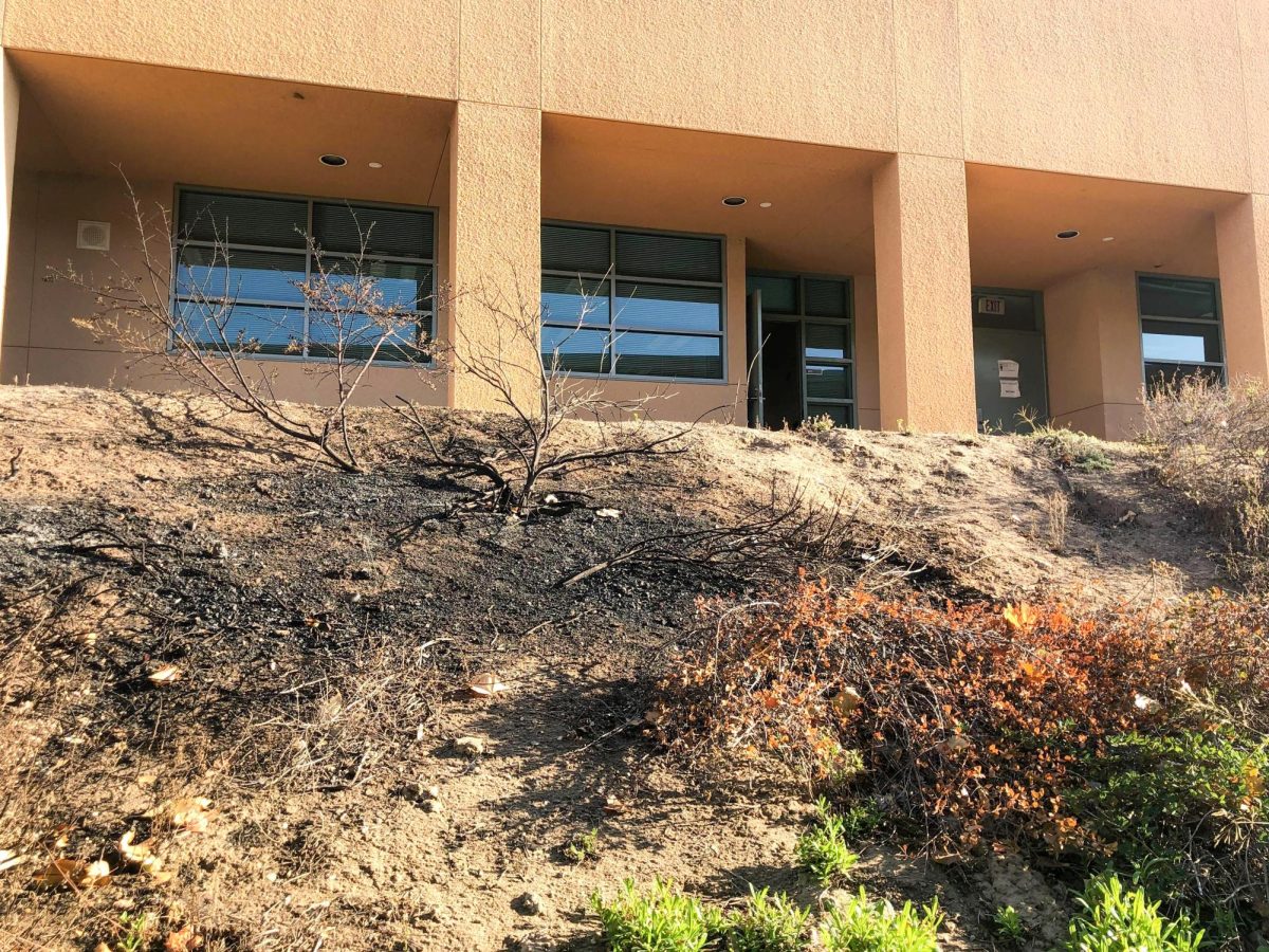
California Department of Forestry and Fire Protection issued updated Fire Hazard Severity Zones on March 24 for Southern California, including the Irvine area, placing Northwood’s campus into the high to moderate danger zones.
The new fire maps, which the Cal Fire has been releasing installments, added an estimated 3.7 million people to hazardous zones, according to CalMatters.The updated zones cover 37% of the state’s land and affect 7.2 million Californians. Northwood staff and students remember the 2020 Silverado fire, which prompted evacuations and burned vegetation around the school.
“The fire that burned through Northwood was a really scary experience for me and a lot of other families near Northwood,” environmental science teacher Angie Olivares said. “It’s important that students stay knowledgeable about the plants and vegetation in their backyard and that they properly take care of them, so that they don’t serve as kindling for fires.”
The maps, which had not been updated since 2011, use models that factor in fire history, fuel, embers and terrain to assign new hazard scores.
They are intended to highlight where residents can reduce fire risk through home hardening and defensible space, and set building rules for new developments like Orchard Hills Reserve near Northwood.
“The reason we map these areas is to tie these really important wildfire mitigations to them, helping us to ensure that as we build out new communities we’re building to the level of hazard that exists, giving them an increased chance of surviving a wildfire,” State Fire Marshal Daniel Berlant said to CalMatters.
Students can stay informed about evacuation procedures by participating in Northwood’s two annual fire drills. Families are also encouraged to review and update their home evacuation procedures.
For more details or to explore the interactive map, visit osfm.fire.ca.gov.
